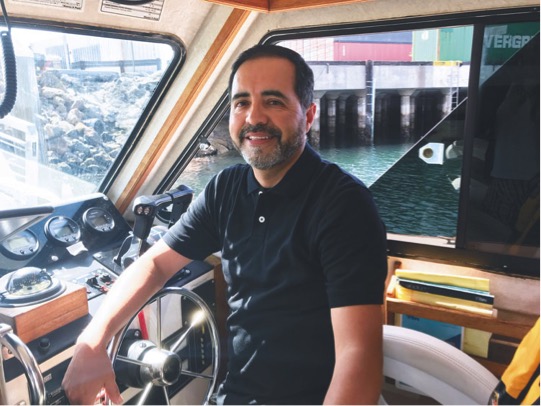
Nicolas Gomez, a hydrographic surveyor for the Port of Long Beach, is responsible for mapping the seafloor within the port’s boundaries. “The maps are used by Port of Long Beach tenants to help out with designing and planning future dredging projects and improvements,” Gomez said. To collect the data used to create the maps, surveyors take a boat out to a given location and gather measurements through sonar, a system that detects objects under the water by emitting sound pulses and tracking the echo created when they bounce off of objects. The process takes anywhere from half an hour to six hours. Back onshore, Gomez extracts the data to create a map. “A lot of surveys we do are along the berth, just to make sure that, when the ships come in, they have enough depth,” he said. Gomez discovered the hydrographic surveying field when he took a surveying class as part of an engineering and architecture program. One of his classmates worked for the Port of Long Beach and posted a listing for internships in the port’s survey division in the engineering service’s bureau. Gomez applied and was accepted. According to Gomez, “making sure everything works on the boat and with the software” is the most challenging aspect of his job. “When something goes wrong, it could throw the whole survey off,” he explained. He most enjoys the ability to see all the phases of a project, from pre-design, to construction and then the final product.